Deep mantle plume may explain puzzling rift motion in East Africa, study finds
A new 3D geodynamic model from Virginia Tech researchers ties more than a decade of unexplained GPS motion in the East African Rift System to the African Superplume, a vast upwelling of hot mantle rock, while a companion GPS study pins down how fast the region's Victoria microplate is rotating.
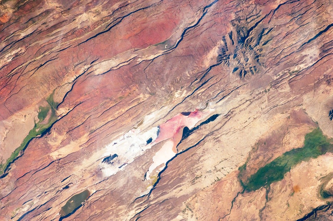
A colossal plume of hot rock rising from deep inside the Earth may explain a pattern of ground movement in East Africa that has puzzled geophysicists for more than a decade, according to new modeling from Virginia Tech researchers published in Geophysical Research Letters.
The East African Rift System, the largest active continental rift on Earth, is slowly splitting the Nubian and Somali tectonic plates apart along a corridor running from the Red Sea south through Ethiopia, Kenya, Uganda and Tanzania. Most of that motion runs perpendicular to the rift, as expected when a continent is stretched. But GPS stations across the region have also picked up a second, harder-to-explain pattern: parts of the crust drifting parallel to the rift itself.
A mismatch GPS could not explain
Geophysicist D. Sarah Stamps first documented the anomaly as a postdoctoral researcher, using ground stations that pull signals from more than 30 satellites orbiting roughly 25,000 kilometers overhead to track surface motion at the millimeter scale. Across more than 12 years of measurements, the rift-parallel drift kept turning up in places that standard models of lithospheric stretching could not account for.
"If you hit Silly Putty with a hammer, it can actually crack and break," said Stamps, an associate professor in Virginia Tech's Department of Geosciences. "But if you slowly pull it apart, the Silly Putty stretches. So on different time scales, Earth's lithosphere behaves in different ways."
To find a cause, postdoctoral researcher Tahiry Rajaonarison, who earned his doctorate in Stamps's Geodesy and Tectonophysics Lab, built 3D thermomechanical models of the region. The simulations point to the African Superplume, an immense body of hot mantle material that rises beneath southwest Africa and flows northeast, growing shallower as it nears the rift. That northward flow, the models show, can produce the rift-parallel motion that surface stretching alone could not explain — and it reproduces a matching pattern in how seismic waves travel through rock beneath the region, a signature called seismic anisotropy.
"We are saying that the mantle flow is not driving the east-west, rift-perpendicular direction of some of the deformations, but that it may be causing the anomalous northward deformation parallel to the rift," Rajaonarison said. "We confirmed previous ideas that lithospheric buoyancy forces are driving the rift, but we're bringing new insight that anomalous deformation can happen in East Africa."
The result adds a second driver to a long-running debate over what powers Africa's breakup. A 2021 study by the same team had found that shallow lithospheric buoyancy forces, tied to a broad zone of unusually high topography called the African Superswell, could explain the ordinary rift-perpendicular stretching but not the parallel anomaly. The new modeling suggests both forces are acting at once, one shallow and one reaching deep into the mantle.
A related GPS analysis from Virginia Tech's DRIAR project, which tracks deformation in Uganda's Albertine and Rhino grabens, has separately pinned down how fast the Victoria microplate — the block of crust wedged between the rift's eastern and western branches — is rotating. That analysis puts the counterclockwise rotation at roughly 0.06 degrees per million years, with a more precisely located rotation axis than earlier estimates and evidence that the plate's northwestern edge is not as rigid as once assumed.
What happens next
Neither paper claims to have settled the debate over what drives continental rifting, a process scientists have spent decades trying to trace from deep-mantle flow down to the earthquakes and fault ruptures it eventually produces at the surface. Researchers say the East African Rift, still in the early stages of splitting apart, offers a rare live laboratory for that work, and Stamps's group plans to keep collecting GPS data as more stations come online across Uganda, Tanzania and Malawi. The findings were first summarized on ScienceDaily on September 1, citing materials provided by Virginia Tech.
"We're excited about this result because it provides new information about the complex processes that shape the Earth's surface through continental rifting," Stamps said.

September Ranks as Earth's Second-Warmest on Record
Google Cuts a Key Quantum-Computing Error 40-Fold in First Real Hardware Test

A common salt mineral could preserve signs of life inside Enceladus's ocean, study finds
